The matching result depends on this step. Indeed, we segment the road network extracted from the image by using criteria related to the cartographic data.
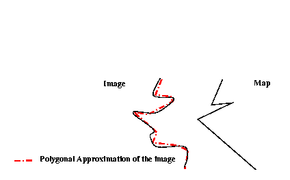
With a simple polygonalization of the image road network, the obtained features can hardly be compared with the segments representing the roads on the map. Indeed, the generalization effect on the map induces some distortions with respect to the ground truth.
With a simple polygonalization, we would have some situations
such as the following:

In such a case, the angle and the length of the image features cannot be compared with those of the map features.