


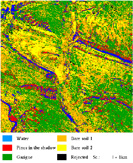
In this precise case, the problem is to differentiate "water" spectrum and "pines in the shadow" spectrum. The following images show that our classification method is better than a classical one for that types of problems.
The TM4 channel of the Landsat scene shows that the intensity of the water and the intensity of the pines in the shadow are very close even in the infra-red channel.
The maximum likelihood classification doesn't succeed in separating those two classes.
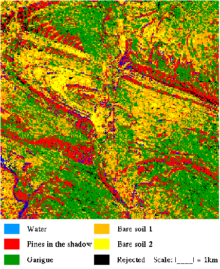
Whereas the mixing percentages classification has correctly done the separation of the two spectra.