- local probings: drillings, wells, tunnels...
- numerical model of terrain
- geological map
- interpreted geological cross-sections
- outcrop informations, directions of interfaces...
|
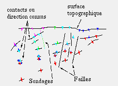
The geological data are incomplete and heterogeneous. They are located on various supports:
- local probings: drillings, wells, tunnels... - numerical model of terrain - geological map - interpreted geological cross-sections - outcrop informations, directions of interfaces... |
|
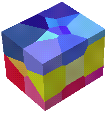 |
The heterogeneous initial data are discretized. The points obtained are assigned a "color", each color corresponding to a geological formation.
The Voronoi diagram of these points gives a decomposition of the space into convex cells. This method yields a volumic representation of the subsoil. |
| The geological formations determined from the Voronoi diagram are then smoothed, using 3D deformable meshes, while keeping the initial topology of the model. | 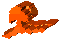 |
 |
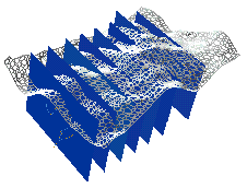 |
Reconstruction of the subsoil of the region of Morges (French Alps) The data on this example are the numerical model of terrain, the geological map, and eight geological cross-sections. These sections are interpreted and incomplete, on more or less parallel planes. | 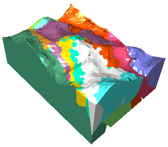 |
| Slides (Stéphane Nullans' defense, in French) |
| Last modified: Thu Nov 9 11:59:53 MET 2000 | Monique Teillaud | Topics |
|
Français |