Results 2/2
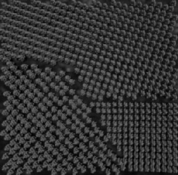
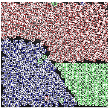
In Fig. (6), the result obtained on an image of 3 plantations simulated with AMAP is presented. This software (see Appendix A.3) gives us the possibility to model our stands and offers a rendering which is very close to natural images. We included in our model an additional mark that represents the label related to the type of plantation for each object. The image is 403x410, and we ran the algorithme for 10 million iterations. From this extraction, we can have access to many statistics such as the number of trees, the diameter distribution and the orientation of the trees in each plantation.
Figure 6:
Left : the original AMAP image, with 3 plantations of different difficulty levels (bottom right one at nadir with perfect alignments, top one not at nadir, bottom left with looser alignments). Right : the extraction result, each ellipse color stands for the mark of plantation that was found.
|
|