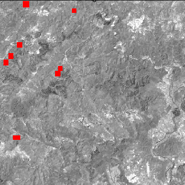
The geographic location of the reference spectra
Each reference spectrum is located in the satellite image. So it is possible to identify the natural land use of the spectrum.

The geographic location of the spectrum S1 (red zones) allows us to determine that the land use is fir trees