Determination of mixture modelling of land use in pixels of a multispectral
satellite image and classification.
Created by Sandrine Mathieu-Marni
The motivation :
-
Preparation of a ground mission for the cartography of the pedologic
landscape.
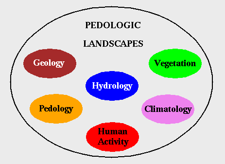
What is a pedologic landscape ?
-
It is the superposition of several criteria linked with the soil, the
substratum and their surroundings.

We are interested with land uses determination (vegetation and human
activity).
We want to obtain :
-
Land uses mixing percentages into pixels of a multispectral satellite
image.
Why ?
-
For the coherence with the information provided by pedologists who work
on the terrain.